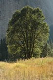
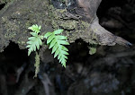
 Last week I packed dog and camera and headed out for the woods. I decided I needed some real exercise, so opted for the Allen Trail just south of High Rock (Main Stem, Eel River) and just north of the con flux (South Fork Eel w/ Main Stem Eel). This trail goes up ... and up ... and keeps going up some more! From the Avenue of the Giants, I park just south of the High Rock Conservation sign. There is a smaller sign for the trail - it's easy to miss. After the first 10 or 15 minutes, the trail brings you here - its a tunnel that goes under the freeway - under 101 - for pedestrians only, of course. From the other side, we progressed up and up some more - at least you know it will be an easy trip back to your car. We passed a small stem with a wonderful little wooden bridge going across, where the trail continues on.....
When I 'googled' Allen Trail, I got a wonderful map complete with elevation information. The total trail ascends some 800 feet! I went perhaps half way so far. Maybe next time I will go all the way to the campground.


No comments:
Post a Comment